Call For Data
GeoCENS is seeking new sensor data. Click here for more info.
GeoCENS - Geospatial Cyberinfrastructure for Environmental Sensing
What is GeoCENS?
The Geospatial Cyberinfrastructure for Environmental Sensing (GeoCENS) project is a user-driven platform that allows scientists to store and share geoscientific and biological sensor data from anywhere in the world. Scientists rely on ground-based sensor information in order to analyze and monitor changes in all forms of environment, including climate, water, and biological species. Researchers can remotely access, exchange, visualize, analyze and download data sets sourced from international sensors, and satellite imagery.

How GeoCENS Works?
GeoCENS makes use of the CANARIE network and various international research networks to allow users to remotely and transparently access, interchange, understand and use heterogeneous sensor networks and their data. This is done independently from underlying network protocols, hardware, data models and formats. GeoCENS follows Open Geospatial Consortium standard information models to achieve sensor/data interoperability.
Discovery Through Launch
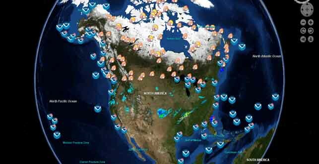
Anyone with an interest in biogeoscience, from industry to researchers to conservationists, are able to log into the portal and use the 3D virtual globe system (similar to Google Earth) to browse geographic areas of interest.
Value to Scientific Research
The portal enables data from the field to be quickly and comprehensively shared with the geoscientific research community worldwide, to promote better understandings. For example, GeoCENS hosts the research network, which focused on surface-water and weather systems in Canada's Rocky Mountains and Western Arctic. By studying this, scientists may reach new conclusions on the effects of climate change on northern water flows.
Where Science Happens
Scientists in the field can remotely update their data the moment they receive it, giving international researchers the chance to instantly access and utilize up-to-the-minute sensor data sets.
Collaborative Networking
GeoCENS users can create profiles, instant message and group chat with others. Login through Facebook or Google accounts is also supported. The networking tools integrated with the portal also enable research projects to be ranked, tagged and recommended to others.
Technology Leadership
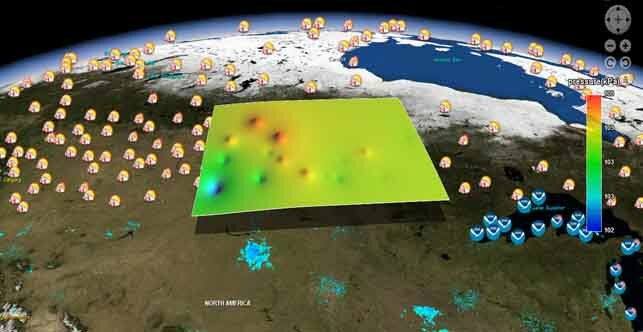
The interactive 3D GeoCENS portal provides access to data from more than 50,000 sensors, 1,750 real-time sensors, and more than 2,000 Web Map Servers. As well as providing the means to visualize and download this data, the project also provides tools to create time series charts.
Investment
This nearly $1.1 million project is jointly funded by Cybera Inc. and CANARIE.
GeoCENS is funded by CANARIE's (Network-Enabled Platform Program) and Cybera Inc.
 |
 |

