Call For Data
GeoCENS is seeking new sensor data. Click here for more info.
Project Partners and Collaborators
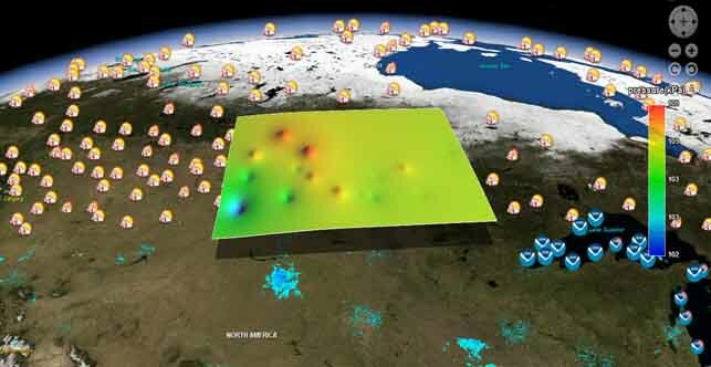
GeoCENS collaborates with several academic and government partners to offer a highly-detailed and interactive sensor-based web portal. The project is jointly funded by CANARIE and Cybera. It has been developed by the GeoSensor Web Lab in collaboration with the Biogeosciences Institute at the University of Calgary, and receives support and contributions from a network of research partners across North America.
See below for more detailed information on GeoCENS’ Principle Investigators and Contributors.
Biogeosciences Institute, University of Calgary |
 The Biogeosciences (BGS) Institute is a multi-disciplinary institute of the UofC. Dr. Edward Johnson is the Director of the BGS Institute and a PI for the GeoCENS project. The BGS Institute has more than 37 scientists from 32 institutions across Canada and internationally. The BGS Institute provides and supports high quality science. The Institute is establishing monitoring arrays that can be used to forecast ecological and geosciences processes for the Rockies and Foothills. Dr. Johnson coordinates the BGS Institutes’ extensive network of scientists to ensure that GeoCENS has the necessary scientific and sensor resources required to complete the project.
Department of Civil Engineering, University of Calgary |

GeoCENS collaborates with Dr. Caterina Valeo, an Associate Professor at the UofC and a BGS Institute Fellow. Dr. Valeo's research includes the impacts of forest fires on climate change analysis; the influence of hydrological processes on forest regeneration; modeling water resources, assessing the impacts of climate change and urbanization on Alberta's water supply; and developing large scale estimates of evapotranspiration and vegetation health with the use of remote sensing. Dr. Valeo participates in the project by providing insight into how data will be used and by testing the effectiveness of the portal.
GeoSensor Web Lab, University of Calgary |

The UofC’s GeoSensor Web Lab, run by Dr. Steve Liang, developed the GeoCENS platform. Dr. Steve Liang is an Assistant Professor in the Department of Geomatics Engineering and the Director of the GeoSensorWeb Laboratory at the University of Calgary. He currently holds an AITF-Microsoft Industry Scholar provincial chair position for Open Sensor Web. Dr. Liang has extensive experiences in sensor web and the development of interoperable geospatial standards. Dr. Liang is currently leading several large scale research projects, such as the CANARIE GeoCENS project, NSERC Sense-able GIS project, and GEOIDE TrafficPulse Project.
IP2 Network & the University of Saskatchewan |
 The University of Saskatchewan (UofS) participates in the GeoCENS project through Dr. John Pomeroy and the Improved Processes and Parameterization for Prediction in Cold Regions (IP3) research network. Dr. Pomeroy is a Tier I Canada Research Chair in Water Resources and Climate Change. He is also the PI for the IP3 Network, which investigates water and weather systems in cold regions, particularly in Canada’s Rocky Mountains and western Arctic regions. The UofS and IP3 provide scientific expertise to the development of the system. They also provide access to two sets of sensor data, which will be integrated into the system.
Cybera Inc. |
 Cybera provides project management for the GeoCENS team, facilitating communication among the project team and CANARIE, the project funder. Cybera is an Alberta-based not-for-profit organization that spurs and supports innovation to advance the economic well-being of all Albertans. Cybera collaborates with public and private partners to accelerate research and product development in priority areas such as health, energy, environment, and emerging technologies. Cybera operates CyberaNet, a high-speed high-bandwidth advanced network in Alberta, and acts as the prime contractor for the management of WestGrid, a consortium that provides advanced computing in support of research across Canada.
CANARIE |
 CANARIE’s flagship Network-Enabled Platform (NEP) Program funds the development of tools and software that help researchers, in a wide range of disciplines, to fully exploit and share the massive amount of data and research that flow along the CANARIE Network. CANARIE supports projects that conform to principles of open systems and interoperability. CANARIE supports a variety of projects that promote the following overarching goals: to facilitate network use; to facilitate the use of distributed systems and equipment; and to reinforce Canada’s position as a leader in the development and use of advanced research networks.
GeoCENS Project Collaborators |
Additional GeoCENS project collaborators, participants and advisors include:
- The California Biodiversity Centre, University of California Berkeley
- The Department of Biological Sciences, University of Cincinnati
- The National Ecological Observatory Network (NEON), Boulder, CO
- The Open Geospatial Cosortium (OGC)
GeoCENS is funded by CANARIE's (Network-Enabled Platform Program) and Cybera Inc.
 |
 |

